
Thank you for supporting this site ❤️
Make a donation
Make a donation
Saint Margarets Copse topographic map
Click on the map to display elevation.
Thank you for supporting this site ❤️
Make a donation
Make a donation
About this map
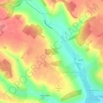
Name: Saint Margarets Copse topographic map, elevation, terrain.
Average elevation: 144 m
Minimum elevation: 99 m
Maximum elevation: 182 m
Thank you for supporting this site ❤️
Make a donation
Make a donation
Other topographic maps
Click on a map to view its topography, its elevation and its terrain.
Nettleden
United Kingdom > England > Hertfordshire > Dacorum > Great Gaddesden
Average elevation: 149 m