
Thank you for supporting this site ❤️
Make a donation
Make a donation
Zhuozi County topographic map
Click on the map to display elevation.
Thank you for supporting this site ❤️
Make a donation
Make a donation
About this map
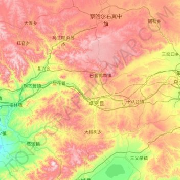
Name: Zhuozi County topographic map, elevation, terrain.
Location: Zhuozi County, Ulanqab City, Inner Mongolia, China (40.64356 111.85297 41.26178 112.95444)
Average elevation: 1,619 m
Minimum elevation: 1,105 m
Maximum elevation: 2,292 m
Thank you for supporting this site ❤️
Make a donation
Make a donation
Other topographic maps
Click on a map to view its topography, its elevation and its terrain.