
Thame topographic map
Interactive map
Click on the map to display elevation.
About this map
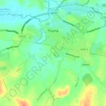
Name: Thame topographic map, elevation, terrain.
Average elevation: 74 m
Minimum elevation: 59 m
Maximum elevation: 102 m
Other topographic maps
Click on a map to view its topography, its elevation and its terrain.
Wittenham Clumps
Vereinigtes Königreich > England > Oxfordshire > South Oxfordshire > Little Wittenham
Wittenham Clumps, Little Wittenham, South Oxfordshire, Oxfordshire, England, OX14 4QZ, Vereinigtes Königreich
Average elevation: 65 m