
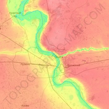
Остров Зелёный topographic map
Interactive map
Click on the map to display elevation.
About this map
Name: Остров Зелёный topographic map, elevation, terrain.
Average elevation: 106 m
Minimum elevation: 63 m
Maximum elevation: 143 m
Other topographic maps
Click on a map to view its topography, its elevation and its terrain.
Омск
Россия > Омская область > Омск > Омск
Омск, Омская область, Сибирский федеральный округ, 644099, Россия
Average elevation: 105 m