
Thank you for supporting this site ❤️
Make a donation
Make a donation
Monte Córdova topographic map
Click on the map to display elevation.
Thank you for supporting this site ❤️
Make a donation
Make a donation
About this map
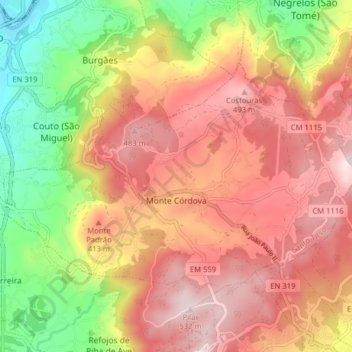
Name: Monte Córdova topographic map, elevation, terrain.
Location: Monte Córdova, Santo Tirso, Porto, Portugal (41.30142 -8.47091 41.33960 -8.39184)
Average elevation: 313 m
Minimum elevation: 34 m
Maximum elevation: 530 m
Thank you for supporting this site ❤️
Make a donation
Make a donation
Other topographic maps
Click on a map to view its topography, its elevation and its terrain.
Thank you for supporting this site ❤️
Make a donation
Make a donation
Alto de São Jorge
Portugal > Porto > Santo Tirso > Carreira e Refojos de Riba de Ave
Average elevation: 414 m
Thank you for supporting this site ❤️
Make a donation
Make a donation