
Herzeeuw topographic map
Interactive map
Click on the map to display elevation.
About this map
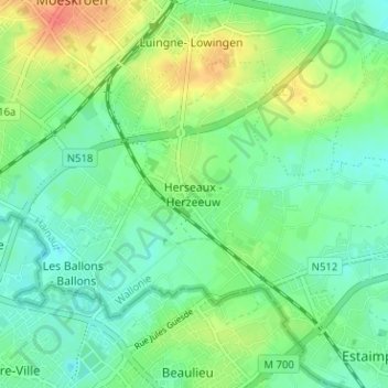
Name: Herzeeuw topographic map, elevation, terrain.
Location: Herzeeuw, Moeskroen, Henegouwen, Wallonië, 7712, België (50.70271 3.21420 50.74271 3.25420)
Average elevation: 34 m
Minimum elevation: 17 m
Maximum elevation: 66 m