
Massenhoven topographic map
Interactive map
Click on the map to display elevation.
About this map
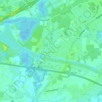
Name: Massenhoven topographic map, elevation, terrain.
Location: Massenhoven, Zandhoven, Antwerpen, Vlaanderen, 2240, België (51.18519 4.62238 51.21355 4.65207)
Average elevation: 8 m
Minimum elevation: 3 m
Maximum elevation: 16 m
Other topographic maps
Click on a map to view its topography, its elevation and its terrain.