
Impe topographic map
Interactive map
Click on the map to display elevation.
About this map
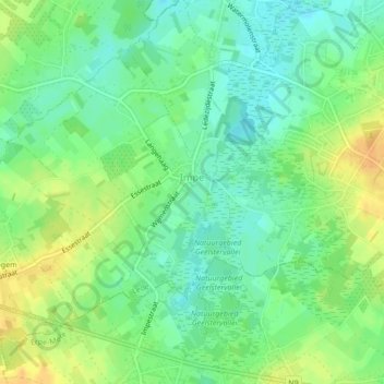
Name: Impe topographic map, elevation, terrain.
Location: Impe, Lede, Aalst, Oost-Vlaanderen, Vlaanderen, 9340, België (50.94920 3.92934 50.96929 3.96190)
Average elevation: 22 m
Minimum elevation: 9 m
Maximum elevation: 38 m
Other topographic maps
Click on a map to view its topography, its elevation and its terrain.
Lede
België > Oost-Vlaanderen > Aalst > Lede
Lede, Aalst, Oost-Vlaanderen, Vlaanderen, België
Average elevation: 14 m
Oordegem
België > Oost-Vlaanderen > Aalst > Lede
Oordegem, Lede, Aalst, Oost-Vlaanderen, België
Average elevation: 24 m
Wanzele
België > Oost-Vlaanderen > Aalst > Lede
Wanzele, Lede, Aalst, Oost-Vlaanderen, Vlaanderen, België
Average elevation: 16 m