
Melch topographic map
Interactive map
Click on the map to display elevation.
About this map
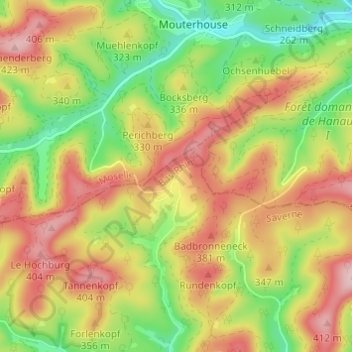
Name: Melch topographic map, elevation, terrain.
Average elevation: 314 m
Minimum elevation: 209 m
Maximum elevation: 416 m
Other topographic maps
Click on a map to view its topography, its elevation and its terrain.
Wildenguth
France > Grand Est > Bas-Rhin > Reipertswiller
Wildenguth, Reipertswiller, Saverne, Bas-Rhin, Grand Est, France métropolitaine, 67340, France
Average elevation: 295 m