
Westtown topographic map
Interactive map
Click on the map to display elevation.
About this map
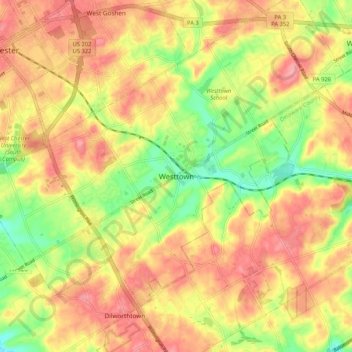
Name: Westtown topographic map, elevation, terrain.
Average elevation: 114 m
Minimum elevation: 62 m
Maximum elevation: 152 m
Other topographic maps
Click on a map to view its topography, its elevation and its terrain.
Darlington Corners
United States > Pennsylvania > Chester County > Thornbury Township > Westtown
Darlington Corners, Westtown, Thornbury Township, Chester County, Pennsylvania, 19382, United States
Average elevation: 111 m