
Niiza topographic map
Interactive map
Click on the map to display elevation.
About this map
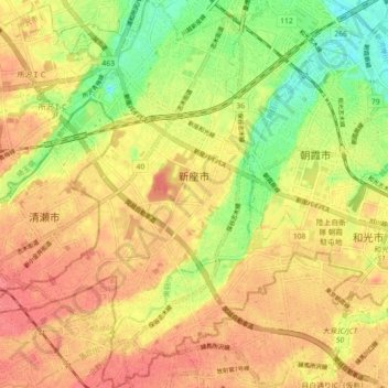
Name: Niiza topographic map, elevation, terrain.
Location: Niiza, Saitama Prefecture, Japan (35.75338 139.51637 35.82582 139.59414)
Average elevation: 38 m
Minimum elevation: 1 m
Maximum elevation: 63 m
Other topographic maps
Click on a map to view its topography, its elevation and its terrain.
Mount Fuji
There are four major routes to the summit, each has numbered stations along the way. They are (clockwise, starting North): Yoshida, Subashiri, Gotemba, and Fujinomiya routes. Climbers usually start at the fifth stations, as these are reachable by car or by bus. The summit is the tenth station on each trail.…
Average elevation: 3,261 m