
Thank you for supporting this site ❤️
Make a donation
Make a donation
Norman topographic map
Click on the map to display elevation.
Thank you for supporting this site ❤️
Make a donation
Make a donation
Norman
Norman and the surrounding areas are mostly flat with an elevation near 1,171 ft (357 m). The terrain in the western section of Norman is prairie, while the eastern section, including the area surrounding Lake Thunderbird, consists of some 6,000 acres (24 km2) of lakes and Cross Timbers forest.
Thank you for supporting this site ❤️
Make a donation
Make a donation
About this map
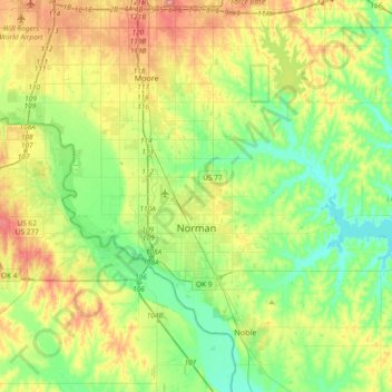
Name: Norman topographic map, elevation, terrain.
Location: Norman, Cleveland County, Oklahoma, United States (35.14532 -97.54745 35.34832 -97.17692)
Average elevation: 358 m
Minimum elevation: 317 m
Maximum elevation: 432 m
Thank you for supporting this site ❤️
Make a donation
Make a donation