
Thank you for supporting this site ❤️
Make a donation
Make a donation
Smyrna topographic map
Click on the map to display elevation.
Thank you for supporting this site ❤️
Make a donation
Make a donation
About this map
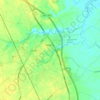
Name: Smyrna topographic map, elevation, terrain.
Location: Smyrna, Kent County, Delaware, 19977, United States (39.25971 -75.63335 39.33246 -75.57702)
Average elevation: 10 m
Minimum elevation: -1 m
Maximum elevation: 19 m
Thank you for supporting this site ❤️
Make a donation
Make a donation
Other topographic maps
Click on a map to view its topography, its elevation and its terrain.
Thank you for supporting this site ❤️
Make a donation
Make a donation
Thank you for supporting this site ❤️
Make a donation
Make a donation