
Glendo topographic map
Interactive map
Click on the map to display elevation.
About this map
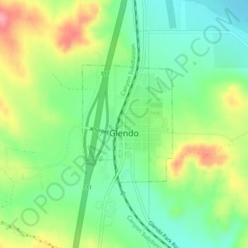
Name: Glendo topographic map, elevation, terrain.
Location: Glendo, Platte County, Wyoming, United States (42.49726 -105.03227 42.51014 -105.01893)
Average elevation: 1,448 m
Minimum elevation: 1,408 m
Maximum elevation: 1,511 m
Other topographic maps
Click on a map to view its topography, its elevation and its terrain.
Wheatland
United States > Wyoming > Platte County
Wheatland, Platte County, Wyoming, United States
Average elevation: 1,454 m