
Thank you for supporting this site ❤️
Make a donation
Make a donation
Aapua topographic map
Click on the map to display elevation.
Thank you for supporting this site ❤️
Make a donation
Make a donation
About this map
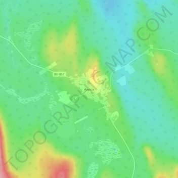
Name: Aapua topographic map, elevation, terrain.
Location: Aapua, Övertorneå kommun, Norrbotten County, Sweden (66.83986 23.50096 66.87986 23.54096)
Average elevation: 192 m
Minimum elevation: 160 m
Maximum elevation: 277 m
Thank you for supporting this site ❤️
Make a donation
Make a donation
Other topographic maps
Click on a map to view its topography, its elevation and its terrain.