
Beaubassin-Est topographic map
Interactive map
Click on the map to display elevation.
About this map
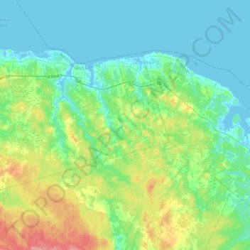
Name: Beaubassin-Est topographic map, elevation, terrain.
Average elevation: 22 m
Minimum elevation: -2 m
Maximum elevation: 90 m
Other topographic maps
Click on a map to view its topography, its elevation and its terrain.
Shediac Bridge
Canada > Nouveau-Brunswick > Shediac Parish
Shediac Bridge, Shediac Parish, Comté de Westmorland, Nouveau-Brunswick, E4R 1Z7, Canada
Average elevation: 4 m