
Rocky Hill topographic map
Interactive map
Click on the map to display elevation.
About this map
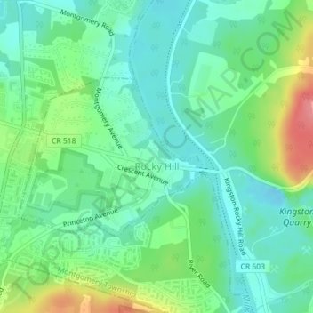
Name: Rocky Hill topographic map, elevation, terrain.
Average elevation: 35 m
Minimum elevation: 9 m
Maximum elevation: 95 m
Other topographic maps
Click on a map to view its topography, its elevation and its terrain.
Bridgewater Township
United States > New Jersey > Somerset County
Bridgewater Township, Somerset County, New Jersey, United States
Average elevation: 58 m
Zion
United States > New Jersey > Somerset County > Hillsborough Township
Zion, Hillsborough Township, Somerset County, New Jersey, United States
Average elevation: 124 m