
La Pousaz topographic map
Interactive map
Click on the map to display elevation.
About this map
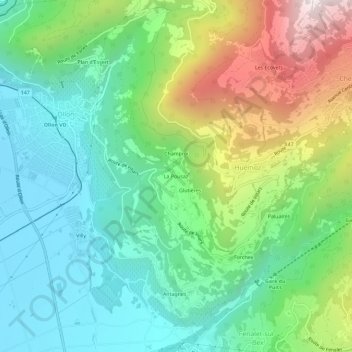
Name: La Pousaz topographic map, elevation, terrain.
Location: La Pousaz, Huémoz, Ollon, District d'Aigle, Vaud, 1867, Suisse (46.27014 6.99316 46.31014 7.03316)
Average elevation: 770 m
Minimum elevation: 395 m
Maximum elevation: 1,579 m
Other topographic maps
Click on a map to view its topography, its elevation and its terrain.
Les Ecovets
Suisse > Vaud > District d'Aigle > Huémoz
Les Ecovets, Huémoz, Ollon, District d'Aigle, Vaud, 1885, Suisse
Average elevation: 1,091 m