
Ohmenheim topographic map
Interactive map
Click on the map to display elevation.
About this map
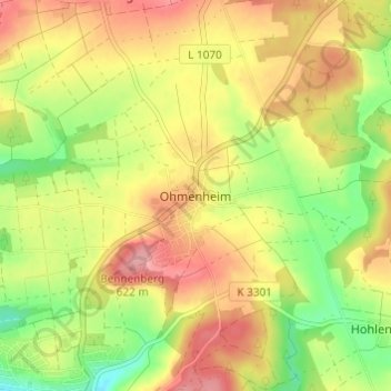
Name: Ohmenheim topographic map, elevation, terrain.
Average elevation: 571 m
Minimum elevation: 512 m
Maximum elevation: 623 m
Other topographic maps
Click on a map to view its topography, its elevation and its terrain.
Schweindorf
Deutschland > Baden-Württemberg > Ostalbkreis > Neresheim > Schweindorf
Schweindorf, Neresheim, Ostalbkreis, Baden-Württemberg, Deutschland
Average elevation: 594 m