
Thank you for supporting this site ❤️
Make a donation
Make a donation
Inari topographic map
Click on the map to display elevation.
Thank you for supporting this site ❤️
Make a donation
Make a donation
About this map
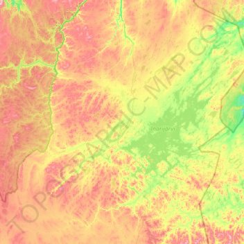
Name: Inari topographic map, elevation, terrain.
Location: Inari, Northern Lapland, Lapland, Mainland Finland, Finland (68.27757 24.90317 69.84919 29.33650)
Average elevation: 256 m
Minimum elevation: 52 m
Maximum elevation: 837 m
Thank you for supporting this site ❤️
Make a donation
Make a donation
Other topographic maps
Click on a map to view its topography, its elevation and its terrain.