
Putnam County topographic map
Interactive map
Click on the map to display elevation.
About this map
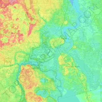
Name: Putnam County topographic map, elevation, terrain.
Location: Putnam County, Florida, United States (29.32443 -82.05615 29.84018 -81.43358)
Average elevation: 17 m
Minimum elevation: -1 m
Maximum elevation: 72 m
Other topographic maps
Click on a map to view its topography, its elevation and its terrain.