
Urumtschi topographic map
Interactive map
Click on the map to display elevation.
About this map
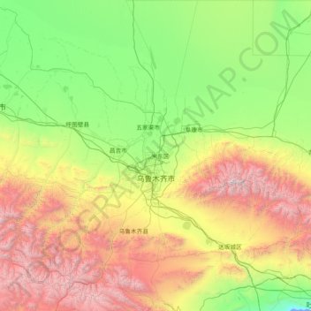
Name: Urumtschi topographic map, elevation, terrain.
Location: Urumtschi, Xinjiang, China (42.92201 86.79397 45.00066 88.97205)
Average elevation: 1,294 m
Minimum elevation: -10 m
Maximum elevation: 5,209 m
Other topographic maps
Click on a map to view its topography, its elevation and its terrain.