
Löhma topographic map
Interactive map
Click on the map to display elevation.
About this map
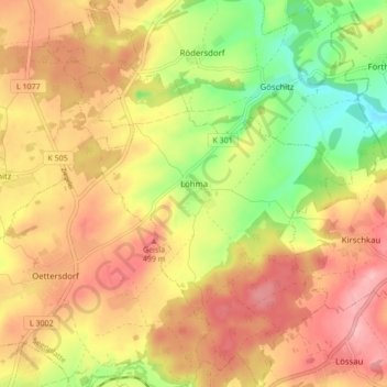
Name: Löhma topographic map, elevation, terrain.
Location: Löhma, Seenplatte, Saale-Orla-Kreis, Thüringen, Deutschland (50.58385 11.81856 50.63826 11.88256)
Average elevation: 454 m
Minimum elevation: 370 m
Maximum elevation: 519 m