
Region of Crete topographic map
Interactive map
Click on the map to display elevation.
About this map
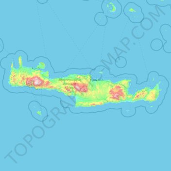
Name: Region of Crete topographic map, elevation, terrain.
Location: Region of Crete, Crete, Greece (34.70061 23.35135 35.79466 26.47587)
Average elevation: 50 m
Minimum elevation: 0 m
Maximum elevation: 2,440 m
Other topographic maps
Click on a map to view its topography, its elevation and its terrain.