
Attenrode topographic map
Interactive map
Click on the map to display elevation.
About this map
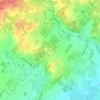
Name: Attenrode topographic map, elevation, terrain.
Location: Attenrode, Glabbeek, Leuven, Vlaams-Brabant, België (50.85457 4.90560 50.88431 4.94070)
Average elevation: 58 m
Minimum elevation: 33 m
Maximum elevation: 96 m