
Thank you for supporting this site ❤️
Make a donation
Make a donation
Fraser topographic map
Click on the map to display elevation.
Thank you for supporting this site ❤️
Make a donation
Make a donation
About this map
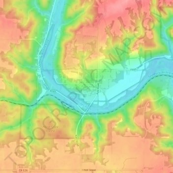
Name: Fraser topographic map, elevation, terrain.
Location: Fraser, Boone County, Iowa, 50223, United States (42.10649 -93.98855 42.14649 -93.94855)
Average elevation: 317 m
Minimum elevation: 265 m
Maximum elevation: 360 m
Thank you for supporting this site ❤️
Make a donation
Make a donation