
Thank you for supporting this site ❤️
Make a donation
Make a donation
Nagoya topographic map
Click on the map to display elevation.
Thank you for supporting this site ❤️
Make a donation
Make a donation
About this map
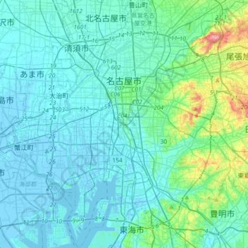
Name: Nagoya topographic map, elevation, terrain.
Location: Nagoya, Aichi Prefecture, Japan (35.02595 136.79197 35.26023 137.06090)
Average elevation: 17 m
Minimum elevation: -12 m
Maximum elevation: 128 m
Thank you for supporting this site ❤️
Make a donation
Make a donation