
Frankenthal topographic map
Interactive map
Click on the map to display elevation.
About this map
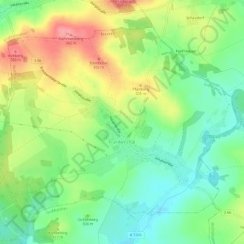
Name: Frankenthal topographic map, elevation, terrain.
Location: Frankenthal, Großharthau, Bautzen, Sachsen, Deutschland (51.11975 14.07606 51.14799 14.13334)
Average elevation: 309 m
Minimum elevation: 271 m
Maximum elevation: 362 m