
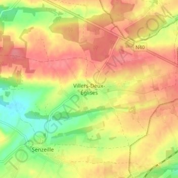
Villers-Deux-Églises topographic map
Interactive map
Click on the map to display elevation.
About this map
Name: Villers-Deux-Églises topographic map, elevation, terrain.
Average elevation: 261 m
Minimum elevation: 219 m
Maximum elevation: 290 m
Superficie. 997 ha — Population. 432 habitants fin 2016 — Altitude au seuil de l’église. 257 m. La commune est bordée à l’est par la Nationale 40 (Arlon-Mons).