
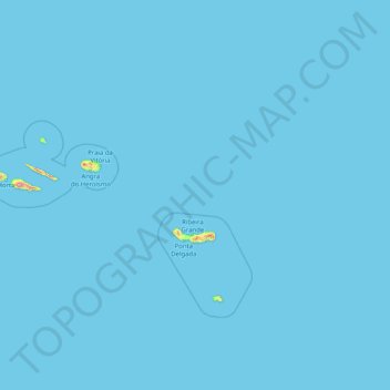
Azores topographic map
Interactive map
Click on the map to display elevation.
About this map
Name: Azores topographic map, elevation, terrain.
Location: Azores, Portugal (36.92763 -31.27563 39.72725 -24.77985)
Average elevation: 2 m
Minimum elevation: 0 m
Maximum elevation: 2,050 m
The same can not be said for the higher altitudes (e.g. Mount Pico), where upper air masses of a continental origin and with a more direct pathway can reach the surface and present those areas with drier air and more extreme temperatures. At the same time, this free atmosphere circulating air transports aerosols to the archipelago, namely volcanic ash or fine sands from the Sahara desert, which sporadically affect the radiation and air quality.
Other topographic maps
Click on a map to view its topography, its elevation and its terrain.
Lisbon
Portugal > Área Metropolitana de Lisboa > Lisbon
Benfica, Lisbon, Grande Lisboa, Área Metropolitana de Lisboa, Portugal
Average elevation: 110 m
São Miguel do Pinheiro
São Miguel do Pinheiro, Mértola, Beja, 7750-628, Portugal
Average elevation: 192 m
Alto do Moinho
Portugal > Setúbal > Seixal > Corroios
Alto do Moinho, Corroios, Seixal, Setúbal, 2855-719, Portugal
Average elevation: 36 m
Carvalheda
Portugal > Aveiro > Vale de Cambra > Roge
Carvalheda, Roge, Vale de Cambra, Aveiro, 3730-384, Portugal
Average elevation: 639 m
Maçãs de Dona Maria
Maçãs de Dona Maria, Alvaiázere, Leiria, Portugal
Average elevation: 288 m
Facho
Portugal > Braga > Vila Nova de Famalicão
Facho, Vila Nova de Famalicão, Braga, 4760-484, Portugal
Average elevation: 151 m
Cascata da Ermida
Portugal > Viana do Castelo > Ponte da Barca
Cascata da Ermida, Entre Ambos-os-Rios, Ermida e Germil, Ponte da Barca, Viana do Castelo, 4980-330, Portugal
Average elevation: 558 m
Vilar de Suente
Portugal > Viana do Castelo > Soajo
Vilar de Suente, Soajo, Arcos de Valdevez, Viana do Castelo, 4970-672, Portugal
Average elevation: 473 m
Pessegueiro do Vouga
Portugal > Aveiro > Sever do Vouga
Pessegueiro do Vouga, Sever do Vouga, Aveiro, Portugal
Average elevation: 188 m
Travanca de Lagos
Travanca de Lagos, Oliveira do Hospital, Coimbra, Portugal
Average elevation: 362 m
Medelim
Portugal > Castelo Branco > Idanha-a-Nova
Medelim, Idanha-a-Nova, Castelo Branco, Portugal
Average elevation: 395 m
Abade de Neiva
Abade de Neiva, Barcelos, Braga, Portugal
Average elevation: 109 m
Vale Covo
Portugal > Leiria > Bombarral e Vale Covo
Vale Covo, Bombarral e Vale Covo, Bombarral, Leiria, 2540-069, Portugal
Average elevation: 71 m
Idanha-a-Nova
Idanha-a-Nova, Castelo Branco, Portugal
Average elevation: 321 m
Veade
Portugal > Braga > Celorico de Basto
Veade, Celorico de Basto, Braga, 4880-195, Portugal
Average elevation: 213 m
Cerqueda
Portugal > Aveiro > Vale de Cambra
Cerqueda, Vila Chã, Codal e Vila Cova de Perrinho, Vale de Cambra, Aveiro, 3730-135, Portugal
Average elevation: 330 m
Afurada
Portugal > Porto > Vila Nova de Gaia
Afurada, Vila Nova de Gaia, Porto, 4400-587, Portugal
Average elevation: 49 m
Vila da Rua
Portugal > Viseu > Moimenta da Beira
Vila da Rua, Moimenta da Beira, Viseu, Portugal
Average elevation: 637 m
Malpica do Tejo
Malpica do Tejo, Castelo Branco, 6000-560, Portugal
Average elevation: 244 m
Figueira de Castelo Rodrigo
Figueira de Castelo Rodrigo, Guarda, Portugal
Average elevation: 537 m