
Malpasset topographic map
Interactive map
Click on the map to display elevation.
About this map
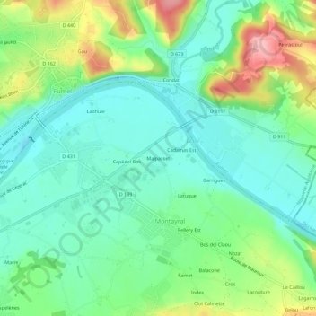
Name: Malpasset topographic map, elevation, terrain.
Average elevation: 104 m
Minimum elevation: 58 m
Maximum elevation: 204 m
Other topographic maps
Click on a map to view its topography, its elevation and its terrain.
Index
France > Nouvelle-Aquitaine > Lot-et-Garonne > Montayral
Index, Montayral, Villeneuve-sur-Lot, Lot-et-Garonne, Nouvelle-Aquitaine, France métropolitaine, 47500, France
Average elevation: 125 m
Péluzac
France > Nouvelle-Aquitaine > Lot-et-Garonne > Montayral
Péluzac, Montayral, Villeneuve-sur-Lot, Lot-et-Garonne, Nouvelle-Aquitaine, France métropolitaine, 47500, France
Average elevation: 99 m