
Make a donation
Gudibanda topographic map
Click on the map to display elevation.
Make a donation
About this map
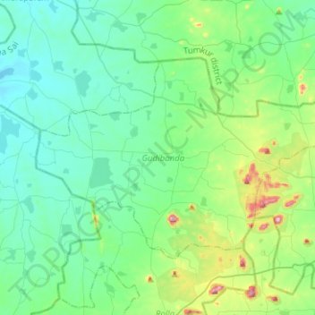
Name: Gudibanda topographic map, elevation, terrain.
Location: Gudibanda, Sri Sathya Sai, Andhra Pradesh, 515271, India (13.89124 76.99544 14.04654 77.24675)
Average elevation: 682 m
Minimum elevation: 602 m
Maximum elevation: 1,009 m
Make a donation
Other topographic maps
Click on a map to view its topography, its elevation and its terrain.
Chittoor
India > Andhra Pradesh > Chittoor
It is located between the northern latitudes of 37" and 14°8" and between the eastern longitudes 78°33" and 79°55". It is bounded on the east by Tirupati district of Andhra Pradesh, on the south by Krishnagiri District , Vellore, Tiruvallur,Thirupattur districts of Tamil Nadu, on the west by Kolar district…
Average elevation: 350 m
Sliding Rock
India > Andhra Pradesh > Kurabalakota > Mandemvaripalli > Sriramavaripalli
Average elevation: 740 m