
Thank you for supporting this site ❤️
Make a donation
Make a donation
Waverly topographic map
Click on the map to display elevation.
Thank you for supporting this site ❤️
Make a donation
Make a donation
About this map
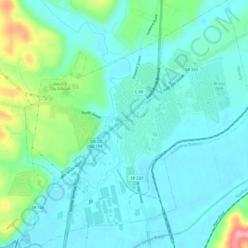
Name: Waverly topographic map, elevation, terrain.
Location: Waverly, Pee Pee Township, Pike County, Ohio, United States (39.10519 -83.00769 39.14696 -82.95792)
Average elevation: 192 m
Minimum elevation: 165 m
Maximum elevation: 290 m
Thank you for supporting this site ❤️
Make a donation
Make a donation
Other topographic maps
Click on a map to view its topography, its elevation and its terrain.