
Thank you for supporting this site ❤️
Make a donation
Make a donation
Neumühle topographic map
Click on the map to display elevation.
Thank you for supporting this site ❤️
Make a donation
Make a donation
Neumühle
Neumühle liegt auf etwa 370 Meter Höhe am Volletsbach. Oberhalb der Ortschaft steht das Schloss Greifenstein. Nachbarorte sind im Norden Reckendorf, im Nordosten Schloss Greifenstein, im Süden Heiligenstadt und im Südwesten Zoggendorf.
Thank you for supporting this site ❤️
Make a donation
Make a donation
About this map
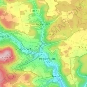
Name: Neumühle topographic map, elevation, terrain.
Average elevation: 453 m
Minimum elevation: 345 m
Maximum elevation: 585 m
Thank you for supporting this site ❤️
Make a donation
Make a donation