
Thank you for supporting this site ❤️
Make a donation
Make a donation
Aloag topographic map
Click on the map to display elevation.
Thank you for supporting this site ❤️
Make a donation
Make a donation
About this map
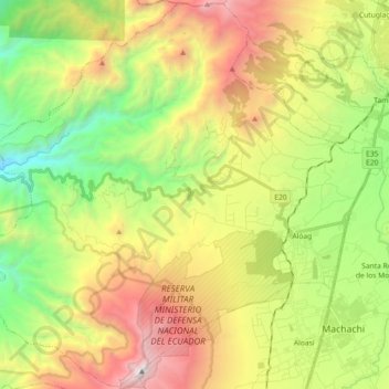
Name: Aloag topographic map, elevation, terrain.
Location: Aloag, Machachi, Pichincha, Ecuador (-0.53897 -78.73395 -0.35977 -78.55229)
Average elevation: 3,109 m
Minimum elevation: 1,912 m
Maximum elevation: 4,771 m
Thank you for supporting this site ❤️
Make a donation
Make a donation
Other topographic maps
Click on a map to view its topography, its elevation and its terrain.