
邵东市 topographic map
Interactive map
Click on the map to display elevation.
About this map
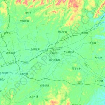
Name: 邵东市 topographic map, elevation, terrain.
Location: 邵东市, 宋家塘街道, 邵东市, 邵阳市, 湖南省, 中国 (27.10431 111.57354 27.42431 111.89354)
Average elevation: 298 m
Minimum elevation: 166 m
Maximum elevation: 841 m