
Holzminden (arrondissement) topographic map
Interactive map
Click on the map to display elevation.
About this map
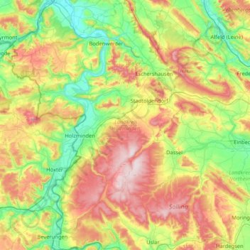
Name: Holzminden (arrondissement) topographic map, elevation, terrain.
Location: Holzminden (arrondissement), Basse-Saxe, Allemagne (51.64595 9.30791 52.04383 9.89502)
Average elevation: 237 m
Minimum elevation: 66 m
Maximum elevation: 529 m
Other topographic maps
Click on a map to view its topography, its elevation and its terrain.
Lauenförde
Allemagne > Basse-Saxe > Holzminden (arrondissement)
Lauenförde, Samtgemeinde Boffzen, Holzminden (arrondissement), Basse-Saxe, 37697, Allemagne
Average elevation: 173 m
Delligsen
Allemagne > Basse-Saxe > Holzminden (arrondissement)
Delligsen, Holzminden (arrondissement), Basse-Saxe, Allemagne
Average elevation: 222 m