
Make a donation
Nasiriyah topographic map
Click on the map to display elevation.
Make a donation
Nasiriyah
Belgian architect, Jules Tilly, was commissioned to develop a modern urban plan for the city. Tilly introduced a Western-style grid layout, characterised by long, straight, and parallel streets intersecting at right angles, unprecedented in Iraq at the time. This planning approach shaped the city’s infrastructure and facilitated the orderly growth of roads and residential plots, which were arranged in rectangular clusters, consequently, the flat topography of the region made this layout particularly effective. Tilly placed great emphasis on urban aesthetics and functionality, incorporating central squares, wide sidewalks, and public gardens into the design. These green spaces quickly became popular as communal resting areas and contributed to the city’s distinctive charm. Tilly’s urban plan received the approval of Medhat Pasha, who praised its elegance, modernity, and engineering ingenuity. The first structure built under Tilly’s plan was the Government House in 1872, which served as the administrative center until its demolition in 1950.
Make a donation
About this map
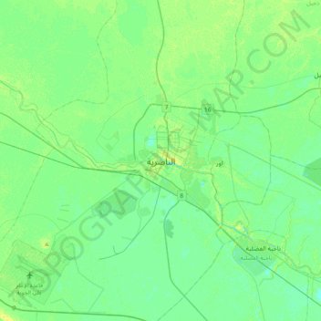
Name: Nasiriyah topographic map, elevation, terrain.
Average elevation: 5 m
Minimum elevation: 0 m
Maximum elevation: 13 m
Make a donation
Other topographic maps
Click on a map to view its topography, its elevation and its terrain.
Make a donation
Make a donation