
El Ataitia topographic map
Interactive map
Click on the map to display elevation.
About this map
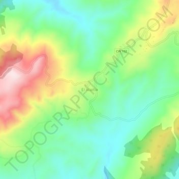
Name: El Ataitia topographic map, elevation, terrain.
Location: El Ataitia, Dahra, Daïra Taougrite, Chlef, 02036, Algérie (36.22226 0.79136 36.26226 0.83136)
Average elevation: 460 m
Minimum elevation: 320 m
Maximum elevation: 700 m
Other topographic maps
Click on a map to view its topography, its elevation and its terrain.
Sidi Moussa
Algérie > Chlef > Daïra Taougrite > Dahra
Sidi Moussa, Dahra, Daïra Taougrite, Chlef, Algérie
Average elevation: 562 m