
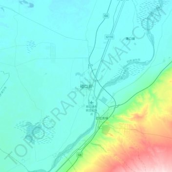
磴口县 topographic map
Interactive map
Click on the map to display elevation.
About this map
Name: 磴口县 topographic map, elevation, terrain.
Location: 磴口县, 巴彦高勒镇, 磴口县, 巴彦淖尔市, 内蒙古自治区, 中国 (40.17342 106.84205 40.49342 107.16205)
Average elevation: 1,082 m
Minimum elevation: 1,043 m
Maximum elevation: 1,325 m