
Taman Desa Sayan topographic map
Interactive map
Click on the map to display elevation.
About this map
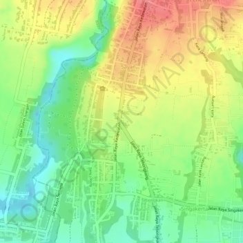
Name: Taman Desa Sayan topographic map, elevation, terrain.
Location: Taman Desa Sayan, Ubud, Gianyar, Bali, 80571, Indonesien (-8.51925 115.23967 -8.51868 115.24024)
Average elevation: 179 m
Minimum elevation: 140 m
Maximum elevation: 217 m