
Lovell topographic map
Interactive map
Click on the map to display elevation.
About this map
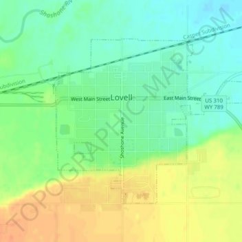
Name: Lovell topographic map, elevation, terrain.
Location: Lovell, Big Horn County, Wyoming, 82431, United States (44.82578 -108.40388 44.84417 -108.37206)
Average elevation: 1,175 m
Minimum elevation: 1,157 m
Maximum elevation: 1,198 m
Other topographic maps
Click on a map to view its topography, its elevation and its terrain.
Frannie
United States > Wyoming > Big Horn County
Frannie, Big Horn County, Wyoming, 82423, United States
Average elevation: 1,292 m
Basin
United States > Wyoming > Big Horn County
Basin, Big Horn County, Wyoming, 82410, United States
Average elevation: 1,188 m
Emblem
United States > Wyoming > Big Horn County > Emblem
Emblem, Big Horn County, Wyoming, 82422, United States
Average elevation: 1,353 m