
Thank you for supporting this site ❤️
Make a donation
Make a donation
Perur topographic map
Click on the map to display elevation.
Thank you for supporting this site ❤️
Make a donation
Make a donation
About this map
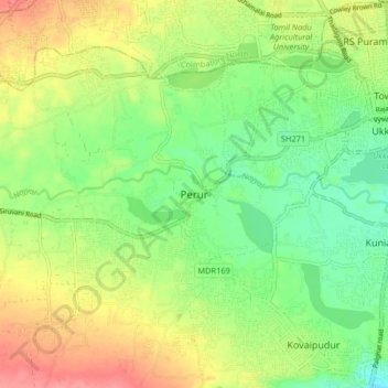
Name: Perur topographic map, elevation, terrain.
Location: Perur, Coimbatore South, Coimbatore, Tamil Nadu, 641010, India (10.93641 76.87418 11.01641 76.95418)
Average elevation: 426 m
Minimum elevation: 391 m
Maximum elevation: 473 m
Thank you for supporting this site ❤️
Make a donation
Make a donation
Other topographic maps
Click on a map to view its topography, its elevation and its terrain.