
Thank you for supporting this site ❤️
Make a donation
Make a donation
Ouled Amar topographic map
Click on the map to display elevation.
Thank you for supporting this site ❤️
Make a donation
Make a donation
About this map
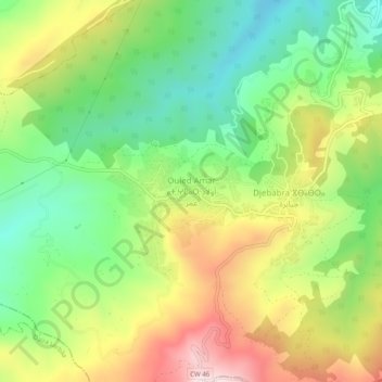
Name: Ouled Amar topographic map, elevation, terrain.
Location: Ouled Amar, Djebabra, Daïra Meftah, Blida, Algérie (36.56419 3.23616 36.60419 3.27616)
Average elevation: 392 m
Minimum elevation: 162 m
Maximum elevation: 713 m
Thank you for supporting this site ❤️
Make a donation
Make a donation
Other topographic maps
Click on a map to view its topography, its elevation and its terrain.