
犀牛望月 topographic map
Interactive map
Click on the map to display elevation.
About this map
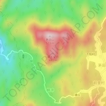
Name: 犀牛望月 topographic map, elevation, terrain.
Location: 犀牛望月, 柏垫镇, 广德市, 安徽省, 中国 (30.73148 119.31293 30.73158 119.31303)
Average elevation: 298 m
Minimum elevation: 121 m
Maximum elevation: 495 m