Ashgabat topographic map
Click on the map to display elevation.
Ashgabat
Ashgabat is in near proximity, approximately 50 km (30 mi), to the Iranian border. It occupies a highly seismically active oasis plain bounded on the south by the foothills of the Köpetdag mountains and on the north by the Karakum Desert. It is surrounded by, but not part of, Ahal Province. The highest point in the city is the 401 metres (1,316 ft) high sandhill upon which the Ýyldyz Hotel was built, but most of the city lies between 200 and 255 metres (656 and 837 ft) of elevation. The Karakum Canal runs through the city.
About this map
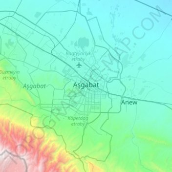
Name: Ashgabat topographic map, elevation, terrain.
Location: Ashgabat, Turkmenistan (37.76865 57.99227 38.10538 58.47864)
Average elevation: 467 m
Minimum elevation: 121 m
Maximum elevation: 2,763 m
Other topographic maps
Click on a map to view its topography, its elevation and its terrain.


Koytendag
Turkmenistan > Koytendag District
Köýtendag is located at an altitude of 265 meters on the banks of the Amu-Darya River, which forms the border with Jowzjan Province, Afghanistan. The Afghan town of Qarqin is on the opposite side of the river. Köýtendag is near the eastern end of Lebap Province, and indeed all of Turkmenistan. The plains…
Average elevation: 277 m