
Thank you for supporting this site ❤️
Make a donation
Make a donation
Quarreux topographic map
Click on the map to display elevation.
Thank you for supporting this site ❤️
Make a donation
Make a donation
About this map
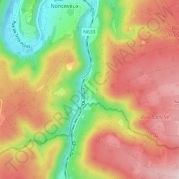
Name: Quarreux topographic map, elevation, terrain.
Location: Quarreux, Aywaille, Liège, Wallonie, 4920, Belgique (50.42791 5.72094 50.46791 5.76094)
Average elevation: 312 m
Minimum elevation: 129 m
Maximum elevation: 478 m
Thank you for supporting this site ❤️
Make a donation
Make a donation
Other topographic maps
Click on a map to view its topography, its elevation and its terrain.
Thank you for supporting this site ❤️
Make a donation
Make a donation
Thank you for supporting this site ❤️
Make a donation
Make a donation