
Menan topographic map
Interactive map
Click on the map to display elevation.
About this map
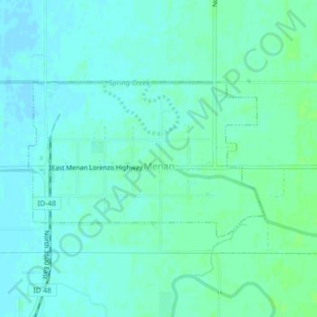
Name: Menan topographic map, elevation, terrain.
Location: Menan, Jefferson County, Idaho, United States (43.71475 -112.00538 43.72793 -111.97753)
Average elevation: 1,465 m
Minimum elevation: 1,461 m
Maximum elevation: 1,469 m
Other topographic maps
Click on a map to view its topography, its elevation and its terrain.
Ririe
United States > Idaho > Jefferson County
Ririe, Jefferson County, Idaho, United States
Average elevation: 1,517 m
Garfield
United States > Idaho > Jefferson County
Garfield, Jefferson County, Idaho, 83454, United States
Average elevation: 1,469 m
Hamer
United States > Idaho > Jefferson County
Hamer, Jefferson County, Idaho, United States
Average elevation: 1,465 m
Rigby
United States > Idaho > Jefferson County
Rigby, Jefferson County, Idaho, 83442, United States
Average elevation: 1,480 m