
Thank you for supporting this site ❤️
Make a donation
Make a donation
Klutmark topographic map
Click on the map to display elevation.
Thank you for supporting this site ❤️
Make a donation
Make a donation
About this map
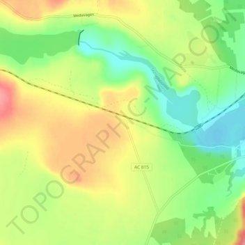
Name: Klutmark topographic map, elevation, terrain.
Location: Klutmark, Skellefteå kommun, Västerbotten County, Sweden (64.70794 20.62723 64.74794 20.66723)
Average elevation: 75 m
Minimum elevation: 36 m
Maximum elevation: 124 m
Thank you for supporting this site ❤️
Make a donation
Make a donation
Other topographic maps
Click on a map to view its topography, its elevation and its terrain.