
Source de la Moselle topographic map
Interactive map
Click on the map to display elevation.
About this map
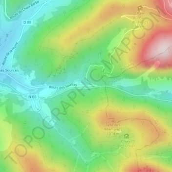
Name: Source de la Moselle topographic map, elevation, terrain.
Average elevation: 833 m
Minimum elevation: 621 m
Maximum elevation: 1,174 m
Other topographic maps
Click on a map to view its topography, its elevation and its terrain.
Les Sources
France > Grand Est > Vosges > Bussang
Les Sources, Bussang, Épinal, Vosges, Grand Est, France métropolitaine, 88540, France
Average elevation: 806 m